Note: This is documentation for version 4.11 of Source. For a different version of Source, select the relevant space by using the Spaces menu in the toolbar above
Combine catchments geographically
Source allows the user to conveniently create the catchment model through Geographic Wizard. Before Source version 4.10.0 - Beta Release (August 2019), however, the user was not able to change the sub-catchment boundary i.e. merge sub-catchments after Geographic Wizard created the scenario. The new function was developed to merge sub-catchments and reset relevant model elements (such as network/link) and attributes (such as rainfall runoff model parameters) in an existing catchment model. The developed function has been included in the Source software tool since the version 4.10.0 – Beta Release.
There are two methods developed for combining sub-catchments: (a) at selected node boundaries and (b) from selected catchments. Both methods are described below in this page.
First of all, the user needs a Source project with a geographic scenario and to open the project.
Combine Catchments At Selected Node Boundaries:
This method allows the user to combine all catchments upstream of the selected node such as a confluence in a catchment model. The use of this method for combining catchments is convent and quick.
The procedure to combine catchments At selected node boundaries is as follows:
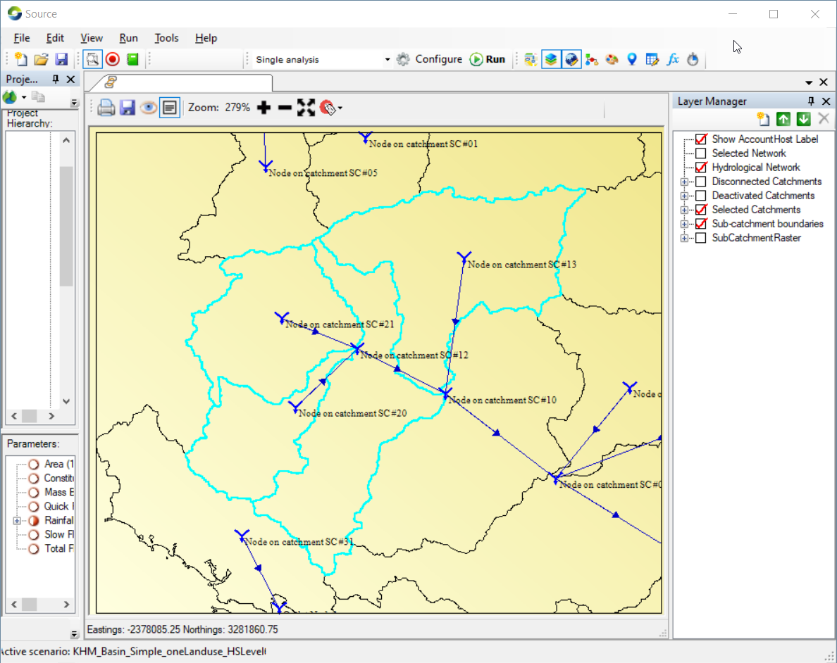
- Click on a single node from the interface to select this node, such as the confluence circled in orange on Figure 1 (i.e. Node on catchment SC#10 in this example).
Figure 1. Selected the node to start Combine catchments function
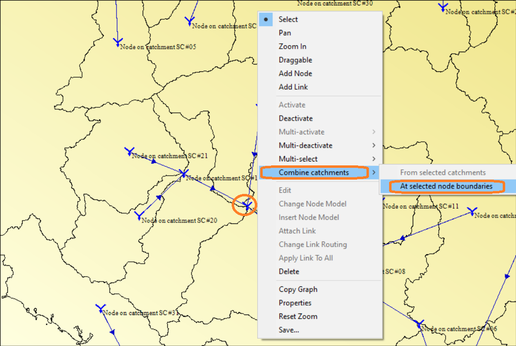
- Right click on the interface’s empty space (this can keep the node selected) to open the Geographic Editor.
- Click on Combine catchments >> At selected node boundaries to display the interface windows of Combine Catchments as demonstrated in Figure 2. At the beginning, the contests under Catchment Group is empty.
Figure 2. Combine Catchments Interface
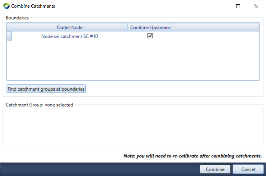
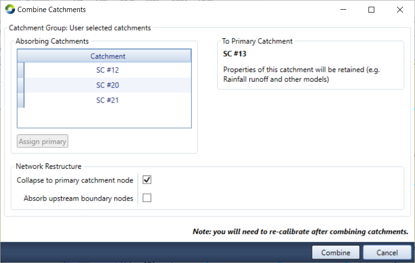
- Click on the button of Find catchment groups at boundaries to display all sub-catchments upstream of the selected node (i.e. Node on catchment SC#10 in this example) in Catchment Groups (shown as Figure 3).
Figure 3. Combine Catchments at the selected node with all found upstream sub-catchments
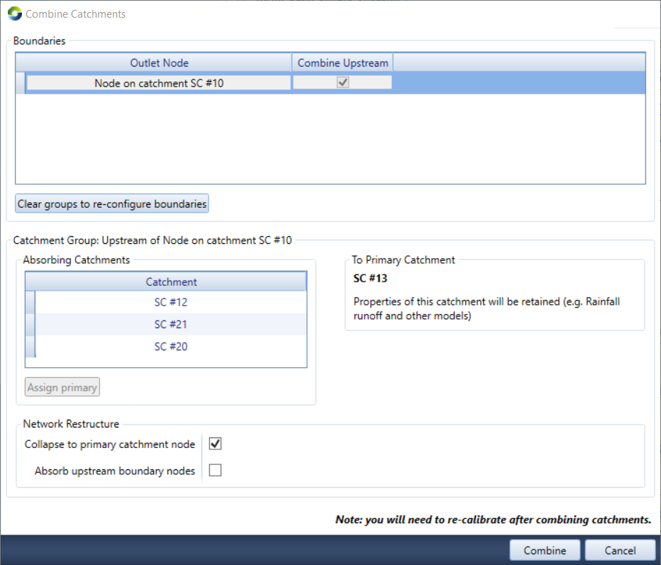
Some functions on Figure 3 are given below:
- To Primary catchment: The property of this sub-catchment will be retained for the combined catchment such as the parameters of rainfall runoff and other models. In this example, the primary catchment is SC#13. The selected node is the single outlet of the combined catchment.
- Absorbing Catchments: Sub-catchment listed under Catchment (i.e. SC #21, SC #12, SC #20 in this example) will be merged with SC #13 and their properties will be discarded.
- Assign primary: This button allows the user to change the primary catchment if the user wants to use a property from another sub-catchment for the combined catchment. The user can click on any sub-catchments listed under Catchment, then click on Assign primary. The selected sub-catchment (SC #12 in this example) will be displayed as Primary catchment, and the previous primary catchment will be moved to the absorbing catchments.
- Network Restructure:
Collapse to primary catchment node – Ticking this function will lead a network with the link from the primary catchment to the outlet. Otherwise, the networks and nodes from all absorbed catchments will be kept as is.
Absorb upstream boundary nodes- This function allows to remove all nodes in absorbed catchments and it is enabled only when Collapse to primary catchment is ticked.
- Clear groups to re-configure boundaries button will clean the found sub-catchments and reset the interface as Figure 2.
- Combine button will close Combine Catchments Interface; combine the catchments upstream of the selected node and reset the network and nodes accordingly.
- Cancel button will close Combine Catchments Interface without any combination action.
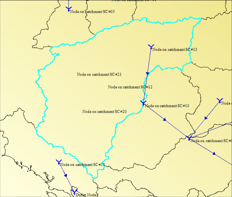
- Click on the Combine button on Figure 3 will get a catchment combined from 4 catchments shown in Figure 4
Figure 4. The result catchment combined from selected node
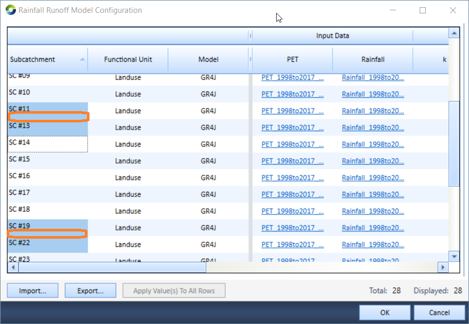
- The associated properties are changed correspondingly For example, the new rainfall and runoff table (Figure 5) shows the sub-catchments #12, #SC 20 and #21 was removed, and the combined catchment inherited the property from SC# 13, the primary catchment, such as ID, parameters.
Figure 5. The result catchment combined from manually selected sub-catchments
Combine catchment from selected catchments:
This method allows the user to manually select the sub-catchments to combine. The use of this method for combining catchments is flexible
The procedure to combine catchments from manually selected sub-catchments is shown below:
- Manually select the sub-catchments (use the Zoom option to Zoom in to the sub-catchments, and keep Selected Catchments in Layer Manager ticked) as demonstrated in Figure 6.
Figure 6. Manually select sub-catchments for combining catchments
- The first catchment selected is deemed to be the Primary Catchment.
- Right click on the interface to pop up the Geographic Editor including the item/function of Combine catchments as Figure 7.
Figure 7. Start Combine Catchments function from manually select sub-catchments
![]()
- Click on Combine Catchments >> From selected catchments to pop up the interface Windows of Combine Catchments as Figure 8.
Figure 8. Combine Catchments Interface for manually selected sub-catchments
- The elements’ functions on Figure 8 are same as those on Figure 3 and the user can refer to details explained before
- Click on the Combine button on Figure 8 will get a catchment combined from 4 catchments similar to Figure 4 before
- Save Source project file to keep the combined results.