Note: This is documentation for version 4.11 of Source. For a different version of Source, select the relevant space by using the Spaces menu in the toolbar above
Groundwater Numerical Model for 1-Dimensional Flow - GN1D
Contents
User Interface
Description of Components
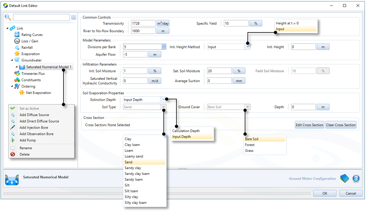
Cross Section
Specifying the topology of the river link via a cross-section is the first step in setting up the GN1D model.
Edit Cross Section | Opens the cross-section editor |
Clear Cross Section | Deletes the cross-section. |
Refer to the Cross Section Editor user guide for details.
Common Controls
These parameters are common with the GAT (Groundwater Analytical Tool) saturated connection model.
Transmissivity | The rate at which groundwater flows horizontally in an aquifer. The transmissivity T for horizontal flow of an aquifer with saturated thickness d and horizontal conductivity Ksat is:
For an unconfined aquifer, d is the average saturated thickness. |
Specific yield | A ratio indicating the volumetric fraction that an aquifer will yield when all water is allowed to drain out of it under the force of gravity:
Vwd is the volume of water drained VT is the total volume of the aquifer material |
River to No-flow Boundary | The distance from the left and right hand river banks to the groundwater no-flow boundary |

Model Parameters
Additional parameters saturated zone, which are required for the finite difference scheme.
Divisions per Bank | The number of subdivisions per bank. |
Aquifer Floor | The z-coordinate of the aquifer basement (no-flow boundary). Uses the coordinate system defined by the cross section. |
Init. Height Method | The method by which the initial groundwater table height is calculated. The two options are:
|
Infiltration Parameters
Unsaturated zone parameters
Init. Soil Moisture | The initial soil moisture content of the unsaturated zone as volumetric fraction of the total volume. |
Sat. Soil Moisture | The saturated soil moisture content as a volumetric fraction. Field soil moisture is the amount of water that will be retained in the soil if it is allowed to drain under the force of gravity. It can be calculated as: Field Soil Moisture = Sat. Soil Moisture – Specific Yield Field soil moisture is displayed in the user interface but is not editable. |
Field Soil Moisture | Field soil moisture is displayed in the user interface but is not editable. Field soil moisture is the amount of water that will be retained in the soil if it is allowed to drain under the force of gravity. It can be calculated as: Field Soil Moisture = Sat. Soil Moisture – Specific Yield |
Saturated Vertical Hydraulic Conductivity | The saturated vertical hydraulic conductivity. |
Average Suction | The average suction at the wetted front. |
Soil Evaporation Parameters
Parameters for setting the maximum depth at which evapotranspiration can occur.
Extinction Depth | Sets the method by which the evapotranspiration extinction depth will be calculated. The extinction depth is the maximum depth below the ground surface at which evapotranspiration can occur. The two options are:
|