Note: This is documentation for version 4.11 of Source. For a different version of Source, select the relevant space by using the Spaces menu in the toolbar above
SIMHYD with routing - SRG
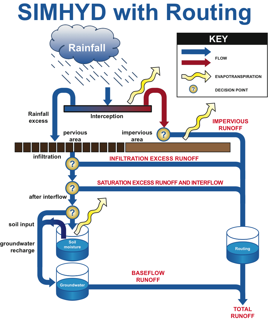
SIMHYD with routing is a conceptual rainfall-runoff model that estimates daily stream flow from daily rainfall and areal potential evapotranspiration data. SIMHYD with routing is similar to the standard SIMHYD model but has an additional store to simulate routing of surface flows.
The model contains stores for interception loss, soil moisture, groundwater and routing. The model has nine parameters.
Scale
SIMHYD with routing operates at a functional unit scale and daily time-step.
Principal developer
Cooperative Research Centre for Catchment Hydrology. SIMHYD is a simplified version of the daily conceptual rainfall-runoff model, HYDROLOG, that was developed in 1972 (see Porter 1972; and Porter & McMahon 1975) and the more recent MODHYDROLOG (Chiew & McMahon 1991).
The SIMHYD with routing model has nine parameters as compared to the 17 parameters required for HYDROLOG and the 19 for MODHYDROLOG.
The SIMHYD model was developed by Francis Chiew in Fortran and converted to C# in TIME by Jean-Michel Perraud. Routing was added by Jai Vaze and Phillip Jordan.
Scientific provenance
SIMHYD has been widely applied to a large number of Australian catchments by several hydrologists (Peel et al., 2000; Chiew et al., 2008). The extent of its use outside of Australia is unknown but the conceptual structure is not particularly limited to Australian catchments and with appropriate calibration and testing it is likely that it could be successfully applied in other countries.
Version
Source v4.3
Dependencies
None
Availability/conditions
SIMHYD is automatically installed with Source. SIMHYD is also available through the Rainfall Runoff Library on eWater Toolkit http://www.toolkit.net.au/Tools/RRL.
Flow phase
The structure of the simple lumped conceptual daily rainfall-runoff model, SIMHYD, is shown in Figure 1.
Figure 1. Structure of the SIMHYD with routing rainfall-runoff model
The fundamental equations of the model are shown in Equation 1 through Equation 10.
| Equation 1 |  |
|---|
| Equation 2 | 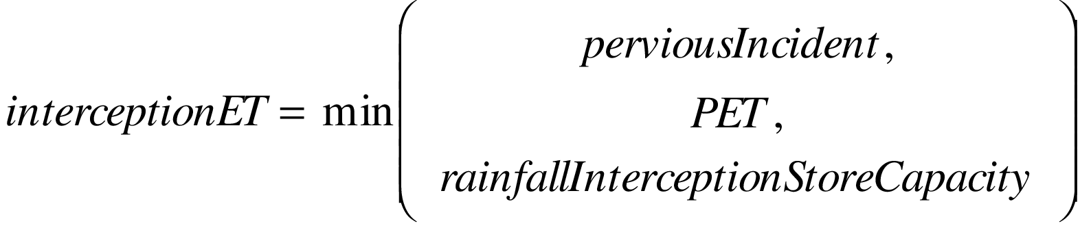 |
|---|
| Equation 3 | 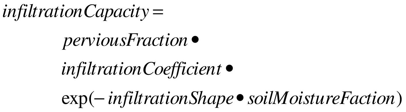 |
|---|
| Equation 4 |  |
|---|
| Equation 5 |  |
|---|
| Equation 6 |  |
|---|
| Equation 7 |  |
|---|
| Equation 8 |  |
|---|
| Equation 9 | 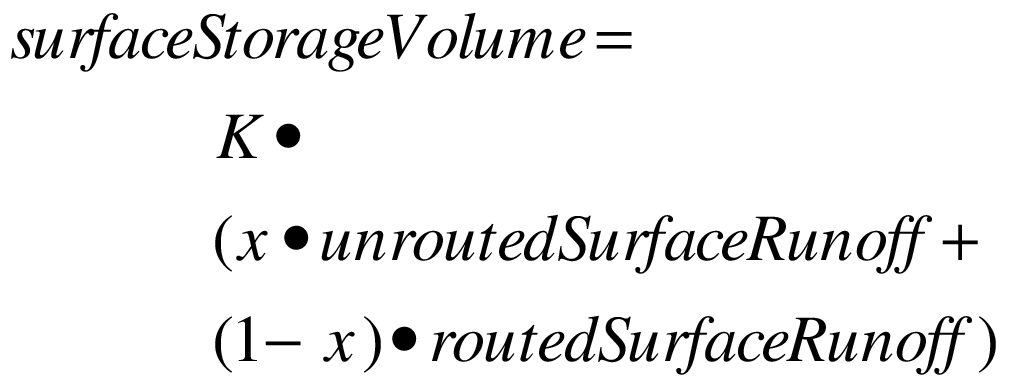 |
|---|
| Equation 10 | 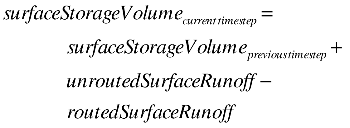 |
|---|
 Daily rainfall data may be obtained from rain gauges or rainfall surfaces but will need to be converted to a time series record that is spatially representative of the whole catchment. Note that the time that rainfall data is collected may be important. Very often rainfall data is collected in the morning, the usual time is 9 am, and may be more representative of the previous day’s rainfall. Daily evaporation is an estimate of the spatially averaged evaporation rate of the catchment being modelled. This estimate is subject to the types of land uses that are in the catchment. This may be estimated by applying a crop/land use factor to daily pan or potential evapotranspiration surface data. |
Daily flow data in ML/day, m3/s or mm/day may be required to calibrate the model.
Selecting stream flow data to use in a river-basin-scale simulation study needs information about the reliability of the data. It is best to use data which are most representative of the stream flow from the catchment. Observed data would normally be selected, except where the data are of poor quality or of unknown reliability. |
Model parameters are summarised in Table 1.
Table 1. Model Parameters
| Parameter | Description | Unitys | Default | Min | Max |
|---|---|---|---|---|---|
Baseflow coeff. | Base flow Coefficient | n.a. | 0.0 | 1.0 | |
Impervious Threshold | Impervious Threshold | mm | n.a. | 0.0 | 5.0 |
Infiltration Coeff. | Infiltration Coefficient | n.a. | 0.0 | 400 | |
Infiltration shape | Infiltration Shape | n.a. | 0.0 | 10.0 | |
Interflow Coeff. | Interflow Coefficient | n.a. | 0.0 | 1.0 | |
Perv. Fraction | Pervious Fraction | n.a. | 0.0 | 1.0 | |
RISC | Rainfall Interception Store Capacity | mm | n.a. | 0.0 | 5.0 |
Recharge coefficient | Recharge Coefficient | n.a. | 0.0 | 1.0 | |
SMSC | Soil Moisture Store Capacity | mm | n.a. | 1.0 | 500 |
K | Surface delay parameter | hours | n.a. | 0.5 | 200 |
x | inflow to outflow bias parameter | n.a. | 0.0 | 0.5 |
The relative sensitivity of parameters will vary between catchments but generally the model is most sensitive to the soil moisture store capacity, pervious fraction and base flow index |
Output data
The model outputs daily surface and base flow. This may be saved in ML/day, m3/s or mm/day.
Configuration
This model requires calibration and validation.
Reference list
Bibliography
Rainfall Runoff Library v1.0.5, June 25, 2004 (http://www.toolkit.net.au/Tools/RRL).
Chiew, F. H. S., M. J. Stewardson and T. A. Mc Mahon (1993). "Comparison of six rainfall-runoff modelling approaches." Journal of Hydrology 147: 1-36.
Chiew, F. H. S. and T. A. McMahon (1994). "Application of the daily-runoff model MODHYDROLOG to 28 Australian catchments." Journal of Hydrology 153: 383-416.
Chiew, FHS, Peel, MC & Western, AW 2002, ‘Application and testing of the simple rainfall-runoff model SIMHYD’, in VP Singh & DK Frevert (eds), Mathematical models of small watershed hydrology and Applications, Water Resources Publication, Colorado, pp.335-367.
Chiew FHS, Vaze J, Viney NR, Jordan PW, Perraud J-M, Zhang L, Teng J, Young WJ, Penaarancibia J, Morden RA, Freebairn A, Austin J, Hill PI, Wiesenfeld CR and Murphy R (2008) Rainfall-runoff modelling across the Murray-Darling Basin. A report to the Australian Government from the CSIRO Murray-Darling Basin Sustainable Yields Project. CSIRO, Australia. 62pp
Peel, M. C., F. H. S. Chiew, A. W. Western and T. A. McMahon (2000). Extension of Unimpaired Monthly Streamflow Data and Regionalisation of Parameter Values to Estimate Streamflow in Ungauged Catchments. Canberra, National Land and Water Resources Audit.
Vaze, J., J.-M. Perraud, N. R. Viney, D. A. Post, J. Teng, B. Wang, J. Lerat and M. Goswami (2010). "Rainfall-runoff modelling across southeast Australia: Datasets, models and results." Australian Journal of Water Resources 14(2): 101-116.